Sep 152014
 

736click to enlarge

This hand tinted postcard from 1911 shows one of the small steamboats of the late era of commercial river travel. Published by James Bruin, Linn Creek, Mo.

While this is rather late in the history of commercial steamer traffic on the Osage, a boat’s arrival still generated much interest, as evidenced by the many folks along the riverbank and hanging on the boat itself.

Sent by “Charlotte” from Linn Creek in July, 1911, to Miss Nellie Nagle in Billings, Missouri. Her message: “… making a drive … Everything delightful.”

People seemed to like Old Linn Creek. The town was up the creek, not right on the river, but in easy walking distance. Infrequent floods happened only if the Osage River backed up significantly. Linn Creek actually had an Upper Town (away from the flood plain) and a Lower Town, around the boat landing on the river in a commercial area.

Aug 202014
 

Osage Delegation meets with Pres. Calvin Coolidge(click to enlarge)

Press Photo, 8 x 10, dated January 23, 1924 (by UNITED)

Official caption pasted on the back of photo:

RICHEST INDIANS GREET PRESIDENT.
The delegation of Osage Indians, in the Capital seeking additional allowances from their government held incomes from oil lands, call at the White House and pose with President Coolidge.

Unfortunately the caption does not identify any of the Osages in the photograph. We wonder if the man on the far left is not Chief Bacon Rind (see previous posts: http://www.dammingtheosage.com/osage-chief-bacon-rind/#comment-196 ). We welcome confirmation of that guess or any identification of others in the photo.

Money generated by the sales of drilling rights had made enrolled Osages “probably the wealthiest people on earth” (New York Times November 18, 1898). Since 1897, oil wells have been drilled in Osage County, Oklahoma. With extraordinary foresight, the tribe had reserved subsurface mineral rights even though the land had been allocated among the 2,229 enrolled Osages. . . . . By the 1920s, those Osages who owned headrights, or shares based on their or their ancestors’ listing on the official rolls of 1906 had become rich from oil revenues.” (page 280, Damming The Osage)

Note the peace medals the two Osage men wear. Genuine medals today are quite valuable, but there are a lot of copies. The otter skin ‘bandeaus’ they wear are characteristic Osage head wear.

Aug 132014
 

Aerial photo of Old Linn Creek before being flooded by Lake of the Ozarks(click to enlarge)

8 x 10 press photo captioned “Move Entire Town to Make Room for World’s Largest Artificial Lake”
(photo credit: ACME)

This press photo dated March 26, 1931 shows what remained of the soon-to-be-covered-with-forty-feet-of-water town of Linn Creek, once the seat of Camden County, Missouri. Many structures had been torn down in this town that was once home to 500+ residents. Some  buildings were moved to the new Linn Creek a few miles away on higher ground. A new county seat was built – Camdenton, Missouri.

There is quite a literature about towns drowned by reservoirs. You can Google “drowned towns” or follow the links below:

http://librarybooklists.org/mybooklists/drownedtowns.htm

Or – for a world view:

http://weburbanist.com/2014/03/10/drowned-towns-10-underwater-ghost-cities-buildings/

The movie Deliverance, based on the novel by James Dickey, is of course about a river about to be impounded. Near the end of the movie there are shots of a church being moved out of the basin.

But back to old Linn Creek – Our assumption was that what they didn’t tear down or move, they burned. Considerable expense was incurred clearing the trees out of the basin for Lake of the Ozarks, but as this photo shows, they didn’t get them all. Timber removal was a surprising percentage of the cost of the whole project. There was some tension between the crews hired to clear the timber and anti-dam residents when the crews ate at the restaurants and used the stores and filling stations of the town.  People in Linn Creek were pretty much against the dam – a sentiment led by J. W. Vincent, editor of the Linn Creek Reveille.

There are a lot of aerial photos of the dam under construction and as the lake filled – but not so many of the demise of Linn Creek.


Aug 112014
 
Surveyor's Plat of Rocky Comfort at Lake of the Ozarks, 1937

Surveyor’s Plat of Rocky Comfort at Lake of the Ozarks, 1937

We can surmise that this is a surveyor’s map of a subdivision of seventy-four lots laid out by then-owners H. O. (Orville) and Ruth Gatlin, notarized on July 6, 1937 by “George Clifford Williams, Notary Public in and for Morgan County.” This mimeographed map handout shows residential lots apparently being offered for sale along the lake shoreline. The Gatlins were pioneer developers to an area as yet largely undeveloped for recreation and tourism, especially along the upper stretches, away from “The Strip” at Bagnell Dam and Osage Beach.

(click to enlarge)

In the early days of the Lake, Union Electric was more concerned with power production than with real estate sales. Truthfully, the sale of shoreline property and vacation homes wasn’t much of a business during the Depression and World War II. It’s possible that some of the current conflict over the intrusion of private shoreline lots into Union Electric property goes back to the early days of the utility company’s sales of shoreline properties. We don’t see on this map any indication that there is between the privately owned lots and the lake a zone that belonged to Union Electric by law. We wonder if this was disclosed to the buyers of these lots back in those days.  It is now alleged that owners have encroached on power company land.  For more info, see Donald Bradley’s article in the Kansas City Star (May 24, 2014), Lake of the Ozarks residents take land dispute to court.

The federal government saw the real estate arm of Union Electric as a  conflict of interest and the company was required to divest itself of large blocks of land around the lake. We’ve recently acquired an early printed brochure of the Willmore Company which “won the 1945 auction of Union Electric’s 42,000 acres ordered by the Securities and Exchange Commission.” Willmore later tried to sell 4,000 of those acres to a local businessman for $10,000, but Buford Foster couldn’t swing the deal. (Page 138, Damming the Osage).  Those acres included virtually the entire Shawnee Bend area with miles of shoreline.

According to Lake historian H. Dwight Weaver, the Gatlins moved to the Gravois Arm of the Lake the same year that the subdivision was platted (1937), purchasing 110 acres where they built Rocky Comfort Lodge. The large rock and frame lodge served guests until it burned in 1942. Rather than rebuild the lodge, the Gatlin’s turned their attention to their boat yard. The boat yard continued through several owners and today is Kelly’s Port Marina. Weaver’s book, History and Geography of Lake of the Ozarks, Vol. Two, provides a two-page account of the Gatlin’s businesses at Rocky Comfort and subsequent ownership of the property.

Mr. Weaver’s books are available through his website: Lake of the Ozarks Books – http://www.lakeoftheozarksbooks.com/

Aug 072014
 

Pastoral and MonumentalPastoral and Monumental: Dam, Postcards, and the American Landscape is an original take on water resource development. Books on dams are usually politicized, often technical, and unnecessarily rhetorical. Rarely are discourses on river blockages as nuanced as Donald C. Jackson’s study. The postcard illustrations and highly readable text document the history of dam building in the United States. The book clearly shows the evolution from small dams that drove water wheels used for grinding grain or sawing lumber to mammoth multipurpose projects, which have debatable justification. Between the nostalgic era of “the old mill stream” and pork barrel government impoundments stand the heroic dams of the Depression. The public’s perception of these developments is extraordinarily told in popular imagery.

The book is as well a phenomenal telling of the rise and fall of the picture postcard. I don’t recall any book on technology that quotes Susan Sontag and Errol Morris. In addition to Jackson’s reputation as a expert on engineering projects, it must also be acknowledged that he has a profound grasp on photography and mass media. Jackson has used postcards and photographs as source material, not merely illustrations of ideas. They contribute to the reader’s understanding of our perception of dams. This is a de facto history of the postcard – as good as any currently out there. People interested in postcards and photography (he includes snapshots and stereo cards as well) would enjoy this book, as well as anyone for or against dams.

It’s a very handsome, substantial book, with color throughout (although many cards are monochromatic) and razor sharp illustrations and an excellent value. I’ve got three shelves of books on dams and this one is perhaps the most fun to look through. Books on important environmental matters need not be boring or pedantic.

Pastoral and Monumental is available on amazon.com for $31.46


Aug 052014
 

July 20, 2014: The last Sunday in Colorado, we made a round trip drive along Trail Ridge Road from Estes Park to Grand Lake.

Grand Lake – elevation 8,367 feet; formed by glaciation 30,000 years ago; estimated depth, 265 feet.

Largest natural lake in Colorado and headwaters of the Colorado River

Grand Lake, Colorado: Largest natural lake in Colorado and headwaters of the Colorado River


July 27, 2014: Back home in Missouri, we made a Sunday drive to the Warsaw area and Truman Dam and Reservoir.

Truman Reservoir – elevation 706 feet; formed by the Corps of Engineers in 1979; average depth 22 feet.

Truman Reservoir on the Osage River: purpose - flood control, hydropower, recreation

Truman Reservoir on the Osage River: purpose – flood control, hydropower, recreation

Mountain lakes are commemorated in paintings, promoted on postcards and praised in poems. One could draw the conclusion that in areas of high relief, lakes are more successful. Even artificial lakes built for both flood control and hydropower purposes are more effective in mountainous areas. Blocking prairie streams with relatively gentle relief – like the Osage and South Grand rivers – creates inefficient flood storage and minimal hydropower possibilities. One would think the Corps of Engineers would have realized this. Actually – they probably did, but they were being incentivized by construction companies and encouraged by delusional local advocates and politicians. Today they would never undertake a marginal project like Truman Dam and Reservoir. Lessons have been learned … at least we like to think so!

Jun 022014
 

From Twain’s portraits of the river and its denizens to romantic photo essays, environmental analyses, and personal memoirs, a river of words about the Mississippi have flowed through the nation’s literary history. It’s an imposing torrent in which to launch an account of generations of legal and political actions that have shaped the ‘river’ as we experience it today.

Mississippi_River_Tragediessters-51Awt-QVnuLMississippi River: A Century of Unnatural Disaster is a tale of hubris told by clear thinking legal storytellers. Describing the high (or low) points of disasters and legislative and political reactions, Mississippi River Tragedies showcases the many and myriad ways that greed arrogance and – mostly – hubristic exertion of will and technology have contrived to constrain and compel the Mississippi River into a tame chute …. Apparently to no avail. For the river still breaks these arbitrarily imposed confines (as recently as 2011) – and still we call these prison escapes “natural disasters.”

Some might think that a book on water resource law, its evolution over generations and its effects on landscape and human culture would be dry, obscure and hard to read.  Very much to the contrary! Authors and attorneys Christine Klein and Sandra Zellmer (self described “Mississippi River children”) spin a highly readable account from the mistakes, blunders, miscalculations, misunderstandings and sheer stupidity or ignorance that have been imposed on the mightiest river of our continent and the people who have tried to control it and those who live along it, with it.

Klein and Zellmer follow policy evolution from the Corps of Engineers “levees only” management of rivers for navigation to the wholesale fortification of the mighty stream with locks and dams creating a ”Stairway of Water” from the river’s headwaters to its confluence with the Ohio River at Cairo, Illinois.  Dams with mammoth reservoirs were built on the main stem of the Missouri River, primary tributary of the Mississippi, to hold back (in theory) or slow down run off from excessive rain or snow melt. Relief valves, called floodways, another ‘tool in the flood-control toolbox’ were conceived following the floods of 1937. Their function was dramatically illustrated in 2011 when the Corps dynamited Bird’s Point levee in southeast Missouri to lower a flooding Mississippi, thus ‘protecting’ the more valuable town of Cairo, Illinois.  Residents of tiny Pinhook, Missouri on the other hand were flooded out, along with 130,000 acres of productive farmland.

After setting the stage of how the Mississippi became an “unnatural river,” the authors recount decade by decade the ‘natural’ disasters that led to legislation aimed at controlling the power of an immense watershed, and the expanding authorities of the Army Corps of Engineers, the federal agency charged with engaging in battle with the river monster.  With the new authorities, Congress provided the Corps legal immunity from liability if floodwaters caused damages in spite of their engineering efforts.

Congress attacked the problem from non-engineering angles as well, expanding disaster assistance programs and establishing and funding the National Flood Insurance Program despite private sector assessment that the risks of insuring flood-prone properties outweighed the benefits (profit potential). These programs combined to allow, even encourage continued development in areas the river once claimed as its natural floodplain.

The authors illustrate legal concepts through case studies and court proceedings bringing into sharp focus how the workings of government and the judiciary impact the daily lives and fortunes of citizens. Immense ‘natural’ disasters from river risings (the 1927 Mississippi River flood and those of 1937, the early 1950s and the Great Midwest Floods of 1993) to hurricanes Betsy and Katrina, are eye-opening tales of legislative reaction, engineering blunders and mismanagement, the evolution of judicial interpretation of laws and policy, and lessons not learned or not implemented.

Their historical perspective on ‘how we got here’ leads to conclusions that are almost stunning in their simplicity but born of painful lessons learned in the aftermath of these ‘unnatural disasters.’  For example, settlement increases in at-risk areas because of the false security offered by levees and dams.  And the simple solution? Discourage development – residential and commercial – in floodplains, even if “protected” by a levee. A recommendation that has been made before, over the decades and not heeded (as an example, read their account of “Chesterfield, Missouri: Building and Rebuilding in a Floodplain.”)

Other recommendations include changing the National Flood Insurance Program or turning it over the private sector to write actuarially sound policies; eliminating immunity for federal agencies – i.e. the Corps – for negligent acts causing flood damage; reforming the metrics used in justifying flood control project – i.e. the easily manipulated cost-benefit analysis used to justify major projects; give nature (rivers) some space to expand and contract in response to seasonal or weather condition.

Theirs is a reasoned and researched account of official policy, legislation, and judicial decisions that have led to the myriad unintended consequences we read about in headlines nearly every spring.

Klein and Zellmer pull back the curtain on Mississippi River “management,” but behind that curtain they don’t find a genial wizard of water resource development. Rather, they uncover a complex story of political, judicial, bureaucratic and scientific confrontation that continues in the courts today. It’s a fascinating account of the river we thought we knew and how it got that way.

It is good to see another book – like John Barry’s Rising Tide – that acknowledges that river management is a confluence of hydrology and politics and culture.

The book is available at www.amazon.com

Postscript:

In 2012 Congress passed a law to reform the National Flood Insurance Program and return it to solvency. Biggert-Waters put in place actuarially sound insurance rates that would reflect the real risks of living in flood prone areas. Following Hurricane Sandy, politicians scrambled to respond to the ire of voters whose insurance rates were about to go up significantly. On March 21, 2014, President Obama signed the Homeowner Flood Insurance Affordability Act of 2014 – repealing many of the reforms contained in Biggert-Waters.

Ironically, the dam-building juggernaut that is the Corps of Engineers has recently shifted focus and begun to include other strategies in their zeal to control moving water. The term “ecosystem services” now describes the role played by wetlands and floodplains in water management.  How such enlightened green measures will interface with their earlier structural methods – which are still very much in place and require ongoing maintenance – remains to be seen

May 282014
 

Consequences (intended or not) and pernicious effects of Truman Dam and Reservoir for residents of the upper Osage River.

We received a fat envelope in the mail a few weeks ago that included an “open letter to the Corps of Engineers” which was published in the St. Clair County Courier in 1997. Written by Lawrence B. Lewis, a retired Episcopal priest, it’s an extended appraisal of the effect of Truman Dam and Reservoir on the residents of St. Clair County. Mr. Lewis’s family immigrated to the upper Osage River in the 1830s.

Mr. Lewis was kind enough to supply this photograph, which shows his father, Bernard Reynolds Lewis (second from right), dangling his feet over the bow of a barge being pushed by a small steamboat called Rambler.  B. R. Lewis served in the U.S. Navy in both World Wars I and II.

osage-navy
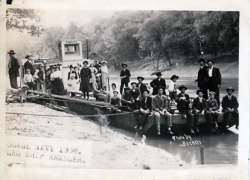
Photo by Becraft, “Osage Navy, 1906, Flag Ship Rambler”

We’re assuming that this was an excursion about to get under way from Osceola to Monegaw Springs as we have a photograph (page 68, Damming the Osage) of an almost identical barge pushed by steamboat, captioned “Excursion – Osceola to Monegaw, June 20, ’09”. Becraft was an excellent photographer in Osceola in the early 1900s. We have a number of his sharp focus, technically excellent photographs in the book.

We always assumed that there were people suspicious of the benefits of Truman Dam in Osceola, but during the lawsuit promoters of the project drowned out their objections. Today, the situation is reversed and it’s hard to find a supporter. Truman Dam is widely recognized to have been a disaster for the town.

With his permission, we republish Mr. Lewis’s letter in its entirety below:


An open letter to the Operations Project Manager,
U. S. Army Corps of Engineers,
Rt. 2, Box 29A,
Warsaw MO 65355.

Dear Diane Parks:

In the September 11, 1997, issue of the St. Clair County Courier, you were quoted as inviting public comment about Truman Dam, after visiting here with our Mayor about the “delta” forming from silt accumulating in Truman Lake at Osceola, and attempting to put the best face on the situation that you could. As someone who has recently moved back home to Osceola because it’s where my wife and I want to live out the years of my retirement, Truman Lake mud flats and all, I’m writing to offer background and also proposals for action concerning the dam and lake.

As Catherine D. Johnson stated in her letter in the September 25 Courier, plans for a new flood control dam date from the 1930s. Then shortly after the close of World War II a proposal was made to construct a flood control dam just upstream from Osceola. Eventually, after it was seen that much of the reservoir would be very shallow, a location was determined on at Kaysinger Bluff near Warsaw.

My father, Bernard R. Lewis, who was born in Osceola in 1896 and died here in 1968, had both historical perspective and a keen interest in the Kaysinger Bluff dam proposal. B. R. Lewis had grown up on the Osage River. When in his teens, along with his brother Lawrence, he ran a passenger boat service between Osceola and the popular rustic summer resort of Monegaw Springs.

B. R. Lewis told me that although the Osage had always flooded, really destructive floods began to occur only after water projects upstream in Bates and Vernon count1es turned meandering streams into straight ditches, and wetlands into crop land, shortly before World War I. The channelization enriched farmers there, but sent floodwater slamming down into St. Clair County and locations farther downstream in amounts not experienced before.

My father’s take on it was that if it had not been for the upstream water projects, then runoff due to poor soil conservation practices especially during the Great Depression, Congress and the Corps of Engineers might not have thought about a large flood control dam in our region.

There was considerable enthusiasm in Osceola for the Kaysinger Dam project in the 1960s. People will tell you now that it was because the Corps of Engineers deceived our civic leaders about the kind of lake the dam would make. I don’t buy that. My father, who was himself an Osceola civic leader, knew the elevation above sea level of the dam at Warsaw, looked at a contour map of Osceola, and figured out that, obviously, we would have mud flats. My guess is that if he said that to other civic leaders, they didn’t want to hear it. In their minds they saw a lake like the one at Warsaw now, because that’s what they wanted to see. Visions of tourism dollars danced in their heads, clouding their vision; but I really don’t think the Corps thrust “delta” predictions in front of their faces to bring them back to reality.

Bernard Lewis was not the only one who did not catch the lake fever. A farmer downstream on the Osage filed suit with assistance from the Environmental Defense Fund (EDF) to stop the Corps from obtaining two farms which had been in the family for generations. The EDF was in 1ts early days, still headquartered in a little town on the north shore of Long Island. They wished to stop construction of Kaysinger Dam 1n order to preserve what was left of the free-flowing Osage River downstream from the old Osceola Dam and above the headwaters of the Lake of the Ozarks. The cover of one their newsletters featured a black and white photo of the Osage from a bluff top.

The farmer and other family members were denounced in the pages of the county paper for bringing in “outsiders” to interfere with a worthwhile project, getting in the way of “progress.” My response was to join the Environmental Defense Fund. Now a quarter of a century later I still send yearly dues to thank them for defending a river that was important in the lives of my father, grandfather and the great-grandfather (Dr. Lawrence Lewis) who moved to Osceola in 1839.

EDF, the farmer and his family and other litigants from the region lost in court. I’m not sure if their suit was related to the requirement that the Corps make a study of the cost-benefit ratio of the project. The hydro-electric power generators may have been added to the project to bring the benefits over the costs. Electricity would be sold to power companies in the heartland of America and the project would pay its way.

The generators were added at great expense and soon proved to be partially unusable because of the massive fish kills caused by their pump-back feature. When he learned of this, I recall that Senator John Danforth termed Truman Dam “an environmental “disaster.” I was glad to hear a respected public servant to say what I’d been thinking.

Why was Kaysinger/Truman Dam built? I turn to another honest, bright government official who spoke his conscience. President Dwight Eisenhower warned citizens about the power of the “military-industrial complex” in a speech he gave in the late 1950s. Army Corps of Engineers dams were the source of juicy contracts for the construction industry. I think of Truman Dam as almost a classic “pork barrel” project. I think of those expensive, fish-killing generators getting added onto the project. Oink

But there is more to it. In the 1960s my father wrote to at least one U.S. Senator to tell him (prophetically, I believe) that the purpose of Kaysinger Dam was to create “a settling basin for the Lake of the Ozarks” – at the expense of the loss to St. Clair County of its best bottomland.

Yes, our flood control reservoir does protect the water level of the Lake of the Ozarks and its bi1lions of dollars of lakeshore investment; and we catch the silt. For those reasons I believe that Truman Dam will never be decomissioned, though I enjoy imagining it.

In all fairness, I believe the Corps has changed since the 1960s. Someone pointed out to me that Truman Dam was one of the last they built. From what 1ittle I’ve heard, it sounds as if the Corps is beginning to have more respect for natura1 processes in the management of waters, more willingness to cooperate with nature rather than fight it. Also, I think they realize how upland conservation has begun to help prevent floods.

You can, though, still   expect to find an image problem among people in and around Osceola on the subject of Truman Lake. I respectfully offer two suggestions of things the Corps might do to help. Both of them have several sub-parts.

  1. The Corps needs publicly and officially to offer a sincere apology to the people of Osceola and St. Clair County, and to do it from the national, not the local or regional level. If you think I mean apologizing for building Truman Dam, that’s too simple. Here is my   list of what the Corps should humbly ask pardon for doing:

–Flooding good bottom land on which farmers grew food to feed a hungry world. Tourist dollars at Warsaw mask the loss of America’s real wealth which was the land.

— Forcing people from their homes and farms. I refer you to the works of Wendell Berry, Kentucky farmer and author, on the value of place; and again to Catherine Johnson’s letter in which she cites the pressure and sometimes deceptive methods by which citizens were displaced. Also, one sometimes hears comments on arbitrary and irregular “take” lines.

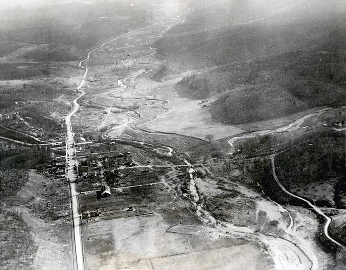
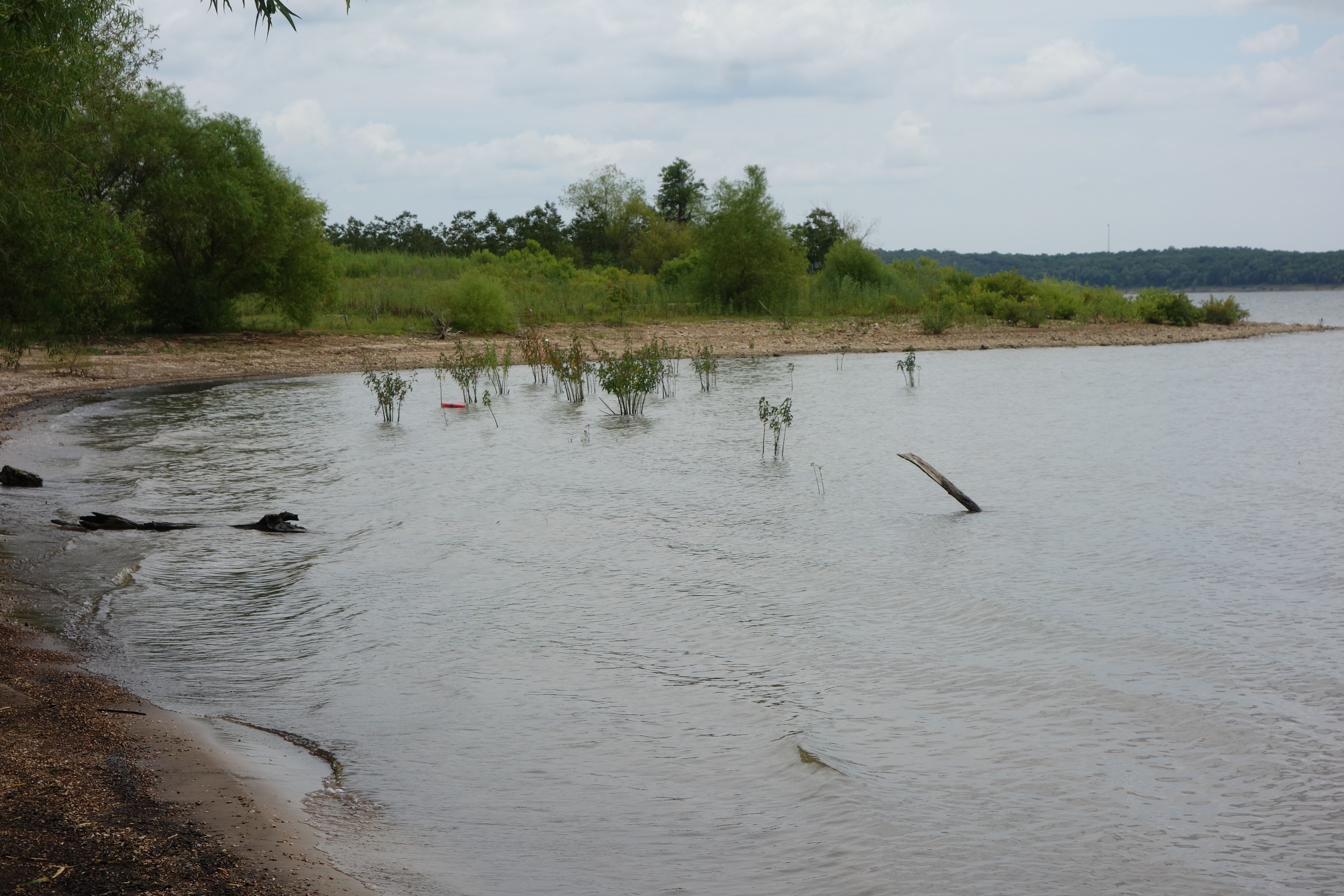
–Flooding riparian forest that moderated our climate and served as habitat for an incredible community of biologically diverse animals and plants. Just go to the Sac-Osage roadside park on Highway 82 and look out over miles of country that used to be green and alive. The devastation pierces the heart.

–Using the flood plain here to protect downstream investments after we had already been used by upstream farmers to receive the excess water they caused by destroying the wetlands which had stored water, then released it slowly.

— Flooding springs.

— Disrupting the life cycles of fish and other aquat1c creatures of the rivers and creeks of the many watersheds involved.

— Destroying, in the town of Osceola, whole neighborhoods with tree-shaded streets and interesting late 19th century houses, many businesses and at least one church.

Reducing Osceola’s populat1on by more than a third by destroying those neighborhoods.

–Destroying Osceola’s unique stone train depot that could have been a worthy nomination to the National Register of Historic Places

–Taking away the rai1road the depot served, thereby necessitating a few more pavement-destroying, life-threatening giant transport trucks on Highway 13. We don’t even have a rails-to-trails project to compensate for the loss of the railroad.

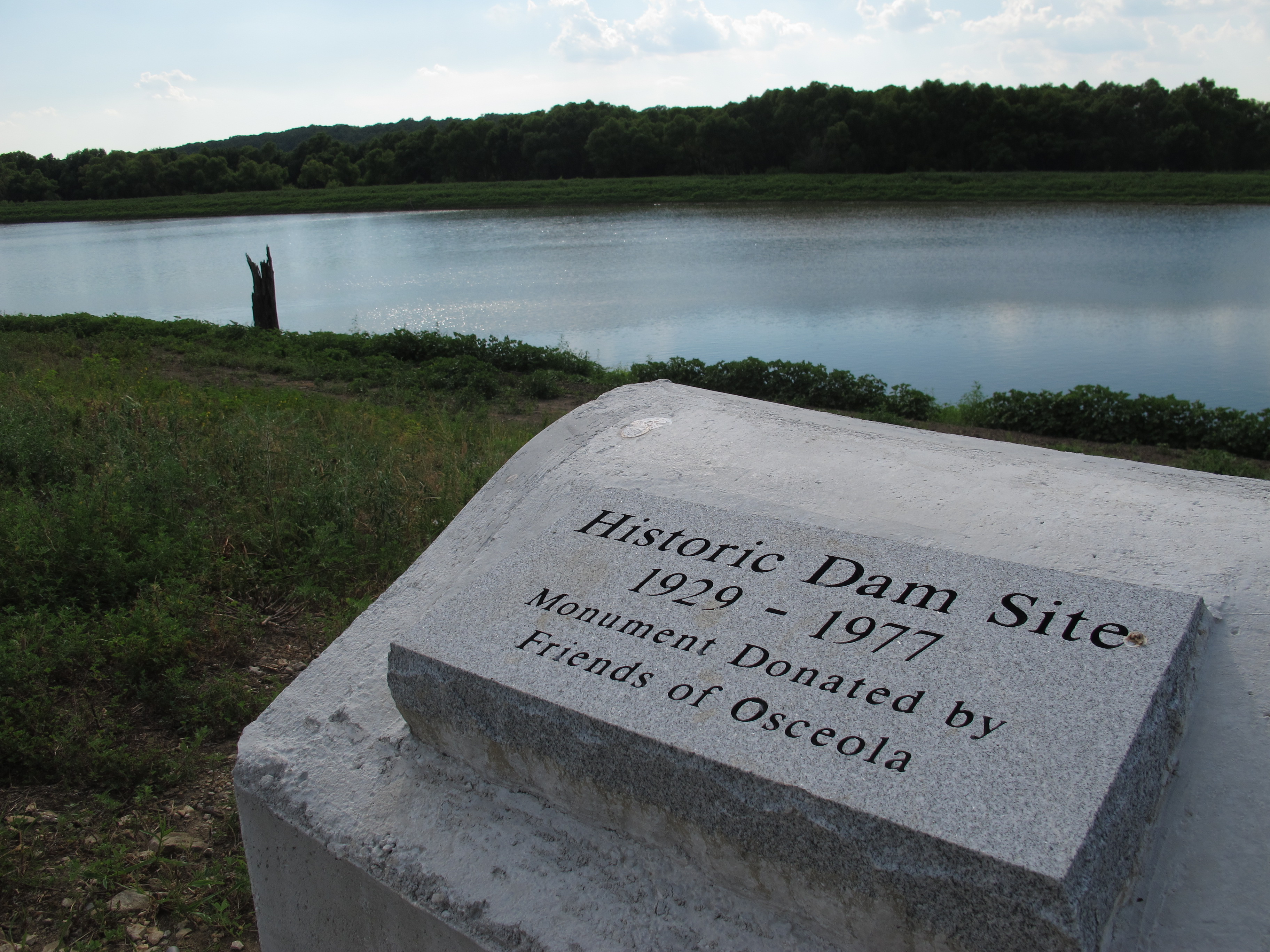
–Using explosives violently to obliterate Osceola Dam, the key symbol in the identity of the Best Town by a Damsite.”

Those are some of the things the Corps needs to apologize for.

Others could doubtless add to the list. A good spokesperson would be Vice President Al Gore. As the author of Earth in the Balance, he would need only minimal coaching as to why an apology is needed. Let the Corps bring him to Osceola to deliver its apology on behalf of the United States of America. Be sure to put the apology in writing as well, and see that it is published widely. For that matter, Mr. Gore’s boss has proved himself teachable, and the office of President of the United States deserves respect, whether or not one likes the person currently holding it. There are two or three Cabinet members who could speak knowledgeably. If you can’t get anyone of Cabinet rank or above, bring whatever Army general heads the Corps of Engineers. Persons of lower rank won’t cut it.   (End of Suggestion # 1)

2) Help us do the best with what we have left. That’s what you   were trying to do when you explained to Mayor Booker about the “delta” (or “fen” as Vincent Foley proposes in his letter in the   0ctober 2 Courier. However, I agree with Jim Dill in his September 25 letter when he says weeds are what will grow there. Developing real bio-diversity takes a long time. It could be a lifetime before Osceola’s “delta” would be comparable to the Schell-Osage Wildlife Area, which is already well established.

Be both smart and gentle in dealings with the City of Osceola. For example, we’ve been stuck with “park” land so abundant we’ll never have the resources to maintain it. Maybe some administrators could tithe a day a month to come work on beautification, for example, mowing.

In spite of the loss of Osceola Dam, a fishing mecca, people still come here to fish. Use tax money to bankroll maintenance of Osceola Cove so both the RV Park put-in and the munic1pal boat ramp will remain usable. Do ongoing dredging to allow boats to get out into the channels of what in better times were the Osage River and its tributaries. The “delta” area will silt up but there will always be a channel.

Be responsible, be accountable, use common sense and kindness in dealing with institutions here which will, it seems, forever be under some measure of Corps supervision. Figure that local people may know more about what’s good for them than people in offices somewhere else, though local support for building the dam shows that we’re capable of error.

Bankroll a civic consultation with Amory Lovins’s Rocky Mountain Institute and a public school consult with down-to­-earth-teach’em-how-it-works David W. Orr, to decrease the likelihood that we locals will again be suckered by Corps experts. Make the non-fiction prose works of Wendell Berry required reading in the Corps, to decrease the temptation to sucker locals in the first place. (End of Suggestion #2)

You don’t have to wait for Suggestion #1 to be accomplished before putting Suggestion #2 into action, though “Cooperative Community Discussion and Planning Meetings” will be better received after the Corps has brought someone from Washington to say it’s sorry for doing violence here, taking away so many things that can never be restored. By the way, if you bring water remediation expert John Todd to instruct me, I’ll be first in line to get in, before or after the apology.

I trust I have provided background for understanding, food for thought and goals for action on the part of the Corps.

Faithfully,

Lawrence B. (“Larry”) Lewis

Priest of the Episcopal Church, Diocese of West Missouri,
Osceola, Missouri, October 4, 1997 (St. Francis Day)

Monument to Osceola Dam on Osage River


May 082014
 

Pollution at Lake of the Ozarks, complicated by denial and cover-ups

Naturally environmentalists are more concerned about the degradation of rivers, especially if they cut through uninhabited, scenic country, than a reservoir whose shores are lined with condos and whose waters are whipped to a froth by cabin cruisers. THE SCARS OF PROJECT 459, journalist Traci Angel’s lively account of water quality problems at Lake of the Ozarks, reports that when concerned citizen Barbara Fredholm contacted the Sierra Club to start a local chapter she was told, “the Lake of the Ozarks is a lost cause.”

459-bookThe Lake’s 55,000 acres of murky Osage River water is held back by Bagnell Dam, which was closed in 1931.  Ostensibly, Project 459 was to supply hydropower to lead mines in eastern Missouri, which were in a downward spiral of operation like all American industries at the beginning of the Depression.  The financing and justifications of Lake of the Ozarks were scandalous.  Two out of three of the drivers of the scheme ended up doing time in federal penitentiaries. The Lake’s origin smells like Polanski’s Chinatown, but without the murders and incest

Today, certain coves at Lake of the Ozarks stink from time to time, polluted by inadequately treated human and animal waste. The politics of dealing with the problem are complex, but driven more from old-fashioned self-interest than out and out corruption.  Still, this book reveals a pattern of inadequate response to a real problem.

It is understandable that the Sierra Club would have a minimal interest in an aging impoundment owned by a power company that is overbuilt and under-regulated, but the book finds the behavior of some politicians and government agencies unforgivable. In 2009 the Missouri Department of Natural Resources delayed releasing until after Memorial Day a report that had found dangerous levels of E. coli bacteria in popular swimming coves, fearing the tourist season would be harmed. The press ran with this story and it became a scandal. Heads rolled in Jefferson City.

Unfortunately, the lesson learned, Angel found, was that now our political and regulatory agencies run and hide when queried about water quality problems.  When she sought an interview with the Missouri Department of Natural Resources, she was told in an email: “We understand that the University of Arkansas Press has contracted with you to write this book, which will be sold for a profit. Given that we are a public agency supported by tax dollars, we have determined that it is not an appropriate use of limited staff time to participate in these types of interviews.”  The implication of such a policy pretty much shuts down the publication of books, newspapers, radio, television and magazines, as they are all “sold for a profit.”  Further, such a policy would shield from public scrutiny information derived from publicly funded research

When she tried to get information from Governor Jay Nixon she was told to check in with the Department of Natural Resources and “insofar as making the Department available for interviews, I believe the Department of Natural Resources is in the best position to make the call on that and I won’t be compelling them otherwise.”

So who will tell the truth about the environmental problems of a geriatric reservoir?  Actually, the author found a scattering of local residents, business people and a few politicians and bureaucrats who do approach the problem straightforwardly.  Apparently Angel herself is part of the American tradition of muckraking journalists – and there’s some smelly muck to rake down there in Lake of the Ozarks.

Modified landscapes, like dammed rivers, are still environments that can be further neglected and abused. Traci Angel does, by the way, point out some outstanding natural features like the spectacular Ha-Ha-Tonka State Park which is intelligently managed by a division of the Missouri Department of Natural Resources which dropped the ball on the pollution issue.

Lake of the Ozarks isn’t a lost cause but its heritage of lies and hype continue to plague its management.

The book is available at www.amazon.com

Apr 232014
 

As paddlefish snagging season nears its end in Missouri, we pay tribute to the its closest cousin, the Chinese paddlefish, (Psephurus gladius), which is likely now extinct.

In the not-too-long-ago but far-away genre of story telling is the tale of the Chinese paddlefish. Once there was another paddlefish species, which lived in the big rivers of China. The Chinese paddlefish, which was a fish eater, not a plankton filter feeder like the American species, grew to more than 20 feet long in the Yangtze River.  According to the National Geographic website, “Their enormous bulk and plentiful flesh made them a popular target for fishermen and a welcome addition to dinner tables, including those of ancient Chinese emperors..”

The largest freshwater fish in the world, this genuine ‘river monster’ was also called ‘elephant fish’ for its trunk-like snout.  Like our Polyodon spathula, the Chinese paddlefish was a river roamer, swimming the long and broad reaches of major streams, but returning to specific environments for spawning.
Psephurus_gladius Psephurus gladius, 1868, Nouvelles Archives du Muséum d’histoire Naturelle (Wikimedia Commons)

OR-paddlefish drawingsDrawing of the American paddlefish (Polyodon spathula) from The Fishery Industries of the United States (1884):

“The Paddle-fish, or Duck-bill cat is one of the most characteristic fish of the rivers of the Western and Southern States. It reaches a length of four to six feet, and a weight of 30 pounds or more. It feeds on minute organisms present in mud. The long snout or spatula is used to stir up the mud on which, and the animals within, the fish feeds. The fish is rarely or never used as food.” (page 204, Damming the Osage)

Chinese rivers are even more dammed than those in the United States. While the big dam building era in the U.S. is past, the Chinese are still going full tilt at nearly every stream in their (and other countries’) geography.  First the giant Gehzouba hydroelectric dam on the Yangtze closed in 1983 blocking the paddlefish migration from feeding areas of the lower river to the Gehzouba, the largest dam in the world, closed in 2006, covering over the remaining spawning areas of the paddlefish.

The last living specimen was captured in 2003.

Ironically, tourists visiting Chinese aquariums see descendants of the American paddlefish swimming in tanks as their own native paddlefish is likely now extinct. Globalization of the American Paddlefish

The American paddlefish remains a viable species for now – but its future is clouded. The changes brought on by water resources development projects have blocked natural spawning. Artificial breeding may seem like a solution, but it leads to long-term deterioration of fitness to survive in the wild. Species maintained by such programs are teetering on a precipice.

OR gravel bars-paddlefishAbove: The upper Osage before Truman Dam. This Ordovician chert floored river was not only ideal for paddlefish eggs to stick to; it was utilized by spawning walleye and introduced striped bass. No other feeder streams of Lake of the Ozarks had an appropriate flow to trigger an upstream migration and satisfy the spawning requirements of these large fish. (Leland Payton photograph, page 205, Damming the Osage).

For more information on the history and current state of the American paddlefish, see DAMMING THE OSAGE