Apr 222016
 

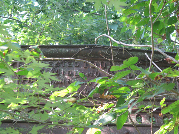
Last week the Kansas Department of Transportation announced a grant to the Fort Scott/Bourbon County Riverfront Authority to help pay for moving the 1902 Long Shoals metal truss bridge from the Little Osage River to the Marmaton River at the Riverfront Park in Fort Scott. The Ft. Scott Tribune carries the full story: http://www.fstribune.com/story/2296125.html

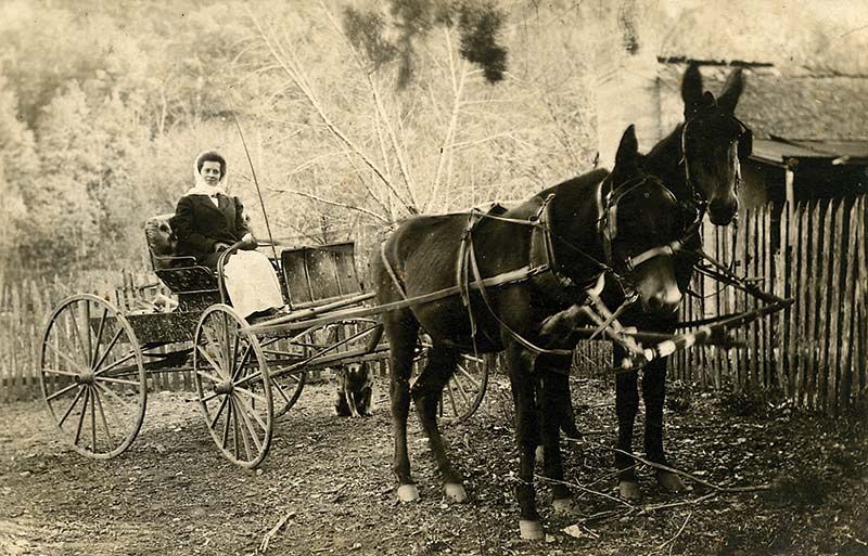
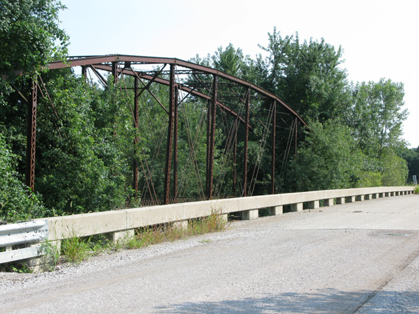
Several years ago, field research for Damming the Osage took us deep into Kansas as we traced the river’s course and the migration of the Osage tribe westward. My “Trip Notes” for one day recorded that we turned east on K-31 “to search for overgrown iron bridge over the Little Osage River, near Kansas-Missouri state line.” We found it. Right next to the uninteresting, but safer, new concrete bridge that replaced it.

My notes continue: “found bridge which is almost completely obscured by trees, vines, foliage. Took many photos but need to come back in winter.” Lesson learned – best iron bridge visuals are when the leaves are off the trees.

IMG_5497-v2 IMG_5499-v2 IMG_5503-v2

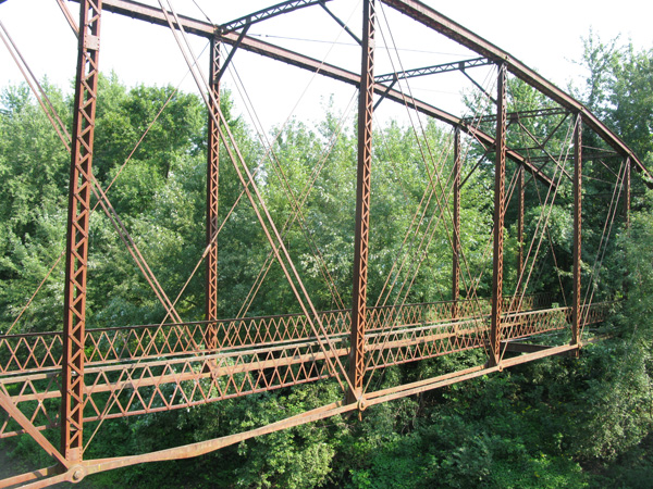
For more and clearer images and technical and historical information on the Long Shoals iron bridge see http://bridgehunter.com/ks/bourbon/long-shoals/

One day, this now-abandoned bridge will grace a park in Fort Scott!  A far better fate than the one that befell the Schell Cty Bridge over the Osage in Missouri – not far from Fort Scott.


Apr 132016
 

sc422Natural Bridge Ha Ha Tonka. Real photo postcard, Published by Jas. Bruin, Linn Creek, MO. Unsent.

Missouri has a lot of natural bridges. One of the largest is at Ha Ha Tonka Statte Park, spanning 60 feet and reaching more than 100 feet into the air. The tunnel through it is 70 feet long. It’s not only one of the larger ones in Missouri, it’s definitely the first one pictured. A crude woodcut of this arch appeared in The First and Second Annual Report of the Geological Survey of Missouri, G. C. Swallow, 1855.

The Natural Bridge is a showcase feature of the Ha Ha Tonka Karst Natural Area in the Missouri State Park acreage surrounding  Robert M. Snyder’s once-palatial country estate.  The park webpage notes: “All of these wonders (the karst features in Ha Ha Tonka park) are the result of the collapse of underground caverns in ancient geological times.”

For a sense of scale, note the four people on the slope above the arch.


Mar 182016
 

sc423

Real photo postcard, published by G. A. Moulder, Linn Creek, MO. Unsent. “Hahatonka, MO” pencilled on back.

We’ve gone back and forth on whether these are ruins or some natural rock formations. Obviously, the castle didn’t burn until much later than when this card was published, which we estimate to be the 19-teens or ‘20s. Does anybody know what this represents?

The Moulder family was  prominent in Linn Creek. While I haven’t precisely identified G.A. Moulder, his family had been in Camden County for decades before this photo was published. Morgan M. Moulder was the prosecuting attorney for Camden County when the dam on the Osage was under construction. He, with other town leaders, tried to stop the dam that would drown their community. The family also owned a hotel in town that, ironically, hosted corporate representatives who came to oversee construction. I

In Nellie Moulder’s memoirs of the town before the dam, she  recalled: “jovial Fred Moulder, who loved children, chipping and sharing slivers of ice to waiting children as he came to the ice house for needed ice in in his meat counter display.” (page 106, Damming the Osage)

Mar 152016
 

sc421

View of Linn Creek, Mo., written in white ink. Published by G. A. Moulder, Linn Creek, Mo. This appears to show high water on the Osage River and shows Linn Creek flooded to varying degrees.

Linn Creek was built at the junction of the Niangua and the Osage and was subject to flooding. Its hardy citizens preferred occasional floods to being fifty feet under water. The town resisted the Bagnell Dam project and fought Union Electric tooth and claw. The little county seat of Camden County would go under forty feet of water twenty years after this photo was taken when Lake of the Ozarks pooled behind Bagnell Dam. Many of the houses would be moved, some were torn down, some burned – mostly foundations were left.

Mar 132016
 

sc424

Real photo postcard. No publisher.

“Dr. Moore L. C. Mo.” is written in red ink. L.C. is Linn Creek Unsent. Penciled on back, “Linn Creek, Mo.” There appear to be some political advertisements pasted in the window. Shows a horse-drawn carriage, sans horses, and a farm wagon hitched to two mules.

Someone really wanted others to know that this scene was in Linn Creek. It says so on the back and twice on the front.  Linn Creek, the seat of Camden County, in spite of being subject to periodic inundation was a thriving little burg before Bagnell Dam. Linn Creek and Tuscumbia were the last towns to have regular steamboat service on the Osage.

Does someone know who Dr. Moore was?


Mar 092016
 

sc417

Real photo postcard published by Jas. Bruin Linn Creek, Mo. This card was never mailed but has a penciled message on the back from Georgia Heaton to Merton Heaton: “This is your little Fluzzy in the hack for a ride. The mules & hack belong to J Bruin the photographer. The one on the left mule yst (sic – used) to be our’s but we sold it to Bruin quite a while. This is by the yard gate.”

Mar 072016
 
Paddlefish have not been spawning naturally on gravel bars in the Osage River since Truman Dam closed almost forty years ago.

Paddlefish have not been spawning naturally on gravel bars like this in the Osage River since Truman Dam closed almost forty years ago.

The monthly feature, “What is it?” in the March issue of the magazine published by the Missouri Department of Conservation has a close up photo of paddlefish eggs. Then the reveal on page 8 correctly states this large ancient fish is the official “state aquatic animal” (so designated in 1997) and lives “mostly in open waters of big rivers.” BUT – then it goes on to incorrectly state: “As waters rise in spring, paddlefish move upstream to gravel bars to spawn. Eggs are deposited on silt-free gravel bars where, during regular water levels, they would be exposed to air or are covered by very shallow water. The eggs hatch and the larval fish are swept downstream to deeper pools where they grow to adulthood.”

paddlefish-1

This is where paddlefish eggs hatch today. There is virtually no natural reproduction in Missouri contrary to the statement in the Missouri Conservationist.

WHAT????! This has not been true for almost forty years. Today all the paddlefish swimming in Missouri streams come from the Department’s Blind Pony Fish Hatchery. Since the Corps of Engineers closed the gates on Truman Dam, destroying the spawning grounds of the paddlefish, there has been only occasional spawning in the Marais des Cygnes in Kansas and no knowledge if these fry survived. The “silt-free gravel bars” are now the muddy bottom of Truman Reservoir.

There are problems with long-term artificial reproduction, as any biologist can tell you. It can create genetic unfitness and it is expensive. The writers and editors of the Conservationist should have consulted with the department’s knowledgeable fisheries biologists (not an old encyclopedia) before printing this outdated misinformation.

DTO-coverWe cover the sordid tale of Truman Dam – and the lawsuit that tried to mitigate its pernicious effects – in great detail in our book Damming the Osage: The Conflicted Story of Lake of the Ozarks and Truman Reservoir. The book is available on amazon.com (http://www.amazon.com/Damming-Osage-Conflicted-Ozarks-Reservoir/dp/0967392586/ref=asap_bc?ie=UTF8 ) or at a discounted price on our website http://www.dammingtheosage.com/buy-the-book/

How much do you want to know about the paddlefish?  https://youtu.be/rmT090b9NT0

“Cemetery Ridge” on the Osage

 blog, Uncategorized  Comments Off on “Cemetery Ridge” on the Osage
Mar 062016
 

One of the best parts of working on a book is the research – specifically the road trips to locations we’re writing about. Hard to believe that eight years ago Damming the Osage was still just the “Osage River book” and we were still photographing out of the way places that were key sites along its banks. The first week of March 2008, we roamed the north side of what is now Truman Reservoir from Clinton to Warsaw and spots in between.

We struck up a conversation with a man from Monegaw Springs who pronounced it ‘Mon-e-goh.’ He was not happy with the state of the river since Truman Dam closed. The lake near them had become a “willow-nasty-ass bottom.” He told us about “Cemetery Ridge” near Monegaw. We hiked through the woods along the ridge (“if you get to the slough you’ve gone too far”) and found a few tombstones leaning against trees, scattered in the woods. Possibly others were stolen as there appeared to be more receivers for the headstones than there were stones.

IMG_0414.-v2  IMG_0420 IMG_0416

Through the trees we caught a glimpse of the backed up waters of the Osage/Truman. The resident of Monegaw was accurate in his descriptor – mud flats were indistinct edges to the trapped water.  Dead tree trunks, broken branches stuck up from the mud. Lost life stories and the lost river …

IMG_0426

Mar 042016
 

sc416The wild scenery at Ha Ha Tonka was appreciated by our ancestors. The walls of the collapsed cavern defied development so they look pretty much today like they did a hundred years ago. The story is (and it’s on most websites about Ha Ha Tonka) that a ring of counterfeiters operated out of this region in the 1830s. We don’t know if they used the cave or not but the name has been affixed to this cave, which is currently off limits at Ha Ha Tonka State Park.

A Chicago Sunday Tribune, April 22, 1956, article about Ha Ha Tonka, “Rainbow Trout Brought a Castle to the Ozark Hills,” describes a driving getaway for Chicago readers at the then-relatively-new Lake of the Ozarks. About Counterfeiters’ Cave, writer Marge Lyon gives a few more details: “There a band of men had turned out excellent half dollars, quarters, and dimes until tracked down by one Augustus Jones, deputy sheriff, in 1834.”

In 1956, it cost a dollar to drive to the ruins and “see stones put together as neatly as books in a case, age-old wonders of nature that have remained unchanged despite dams, castles, hard roads, and all other human innovations that have been brought to this area.”

This is a real photo postcard, by Jas. Bruin, Linn Creek, Mo., postmarked Linn Creek, 1910. It was mailed to Georgia Heaton, Joplin, MO. The penciled writing on the correspondence side of the card is too light to read.

BTW – before the name Ha Ha Tonka, this area was called Gunter Spring, for John Gunter, an earlier landowner from Alabama. More on that later!

Jul 092015
 

Flooding along the Osage River has made news this week. #LakeoftheOzarks filled to over capacity with flood gates roaring.

The swinging bridge in this video spans Greatglaize Creek near Brumley, in Miller County. Designed by Joe Dice in the first quarter of the 1900s, this is one of a number of ‘swingers’ the self-taught engineer built. It’s almost 100 years old and still used by local traffic (when the creek’s not high!). Driving across is a noisy and exhilarating experience as the narrow planks rattle and the bridge sways. Cars roll slowly.

Frightened cattle or overloaded trucks broke the deck of some and tornadoes wrecked others, but no Dice bridge ever structurally failed.

Damming the Osage, page 74

Read more about Dice in our book.

Thanks to Shawn Kober and his Big Planet Media for permission to post this very cool aerial footage of flooding on Greatglaize Creek, a tributary of Lake of the Ozarks.